News
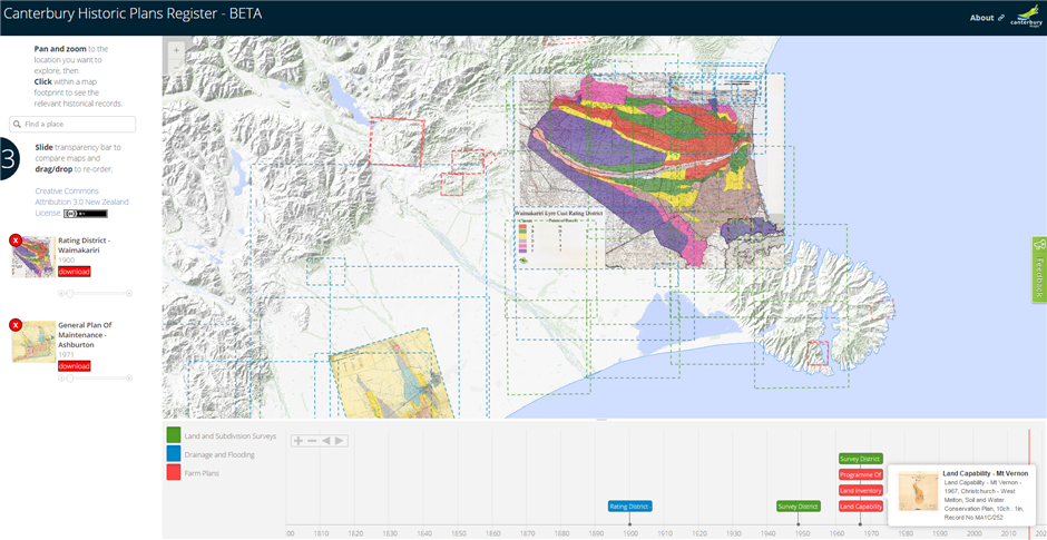
The Canterbury Historic Plans Register is an interactive application built to share our history.
Environment Canterbury holds land use, subdivision surveys, drainage, flooding and farm plan records dating back as far as the 1820’s. The plans have come from predecessor agencies including Canterbury region’s United Councils and Catchment Boards, Pest Boards and Harbour Boards.
A sample set of these plans have been georeferenced (at a coarse level) and documented with relevant metadata drawn from the maps. Some of the metadata may be incorrect or lost over time. If you notice anything that is incorrect, or can fill in the missing information, please use the feedback button on the right hand side to let us know.
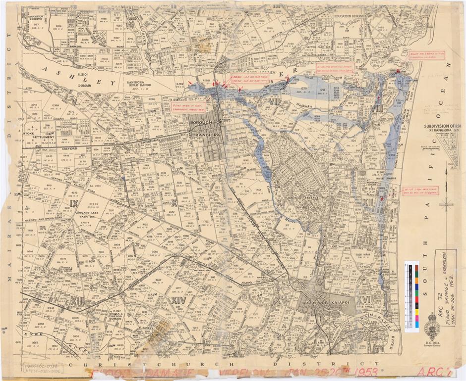
Below is an example of the kinds of records that can be found in our collection. This map highlights the flood damage and overflow extents (seen in blue) from the Ashley River Catchment in 25th – 26th January 1953. The plan also includes historic land subdivisions and original road networks.
Follow the step-by-step instructions below to view and download desired records. Please read the about information (found in the top right corner of the application), before downloading.
- Find your location of interest by using the pan/zoom or search functions.
- Use the timeline navigation tools or legend categories to sort the records. Selecting a record on the timeline will allow you toview it on the map.
- On the left you are able to reorder/remove any loaded maps and adjust their transparency; a download button is also provided.
For additional application help click here...
We welcome your feedback – the application is in BETA so now is a great chance for you to get involved! Let us know what you are interested in seeing in the Canterbury Historic Plans Register; how easy you have found it to use; any comments you would like to make to help us make it a valuable tool for you.