News
New LiDAR in the Selwyn and Christchurch City areas is available now from our Open Data Portal!
And new Aerial Imagery covering the below areas is coming soon!
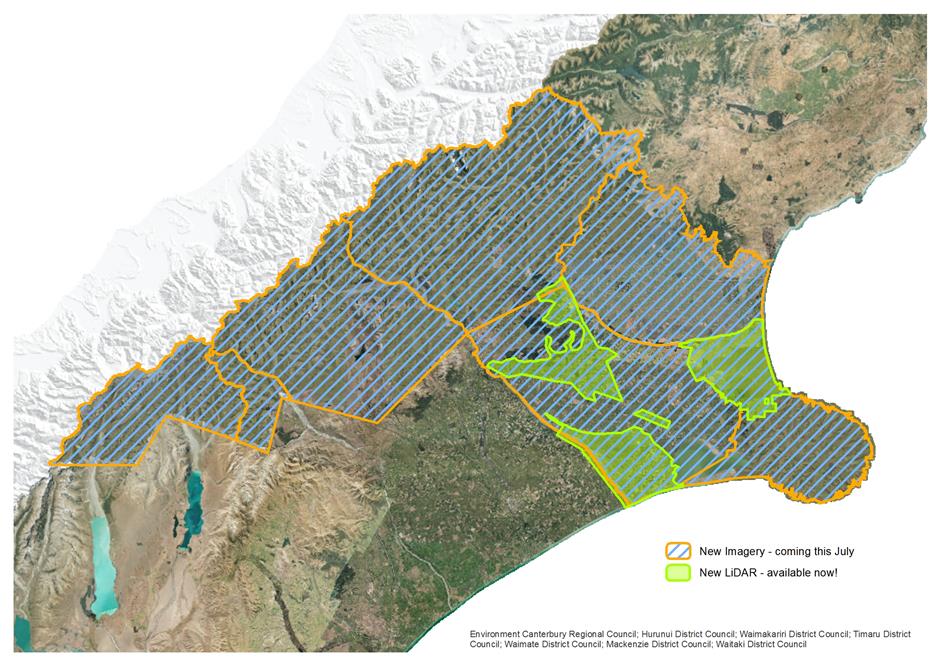
This new aerial imagery and LiDAR is made possible through the collaboration of the Canterbury Maps Partners, Land Information New Zealand and a number of private companies. Each year new areas of capture are agreed on and tendered with capture occuring between late September and April. Processing is done over the autumn months with delivery occuring mid year in winter. So you can expect to see new imagery in Canterbury Maps sometime after July each year.
This programme is linked to the National Imagery Coordination work by Land Information New Zealand.