Age of Aerial Imagery
One of our most frequently asked questions is "What is the age of the aerial imagery?". Find out how to find the date of capture for the latest imagery and also the historic imagery by following these steps:
Latest Aerial Imagery
1. Open the Map Viewer
2. Tick the ‘Latest Imagery Dates’ layer on in the layer list. When this layer is on, you will see the orange boundaries outlining each imagery dataset on the map.

3. Click the map where you want to know the date of the imagery. You will now see the boundary is highlighted in blue and you will see a pop-up window containing information about the imagery including the date flown. Sometimes these datasets are captured over a series of days or weeks.
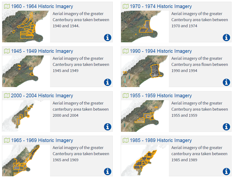
Historic Aerial Imagery
1. Search for Historic Imagery through explore.
2. Click on the historic year group map of interest.
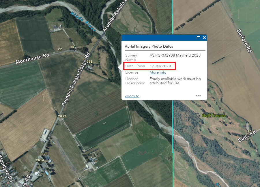
3. In the map viewer, open the layer list and tick on the historic imagery footprints.
4. Zoom into the map and click on the image. A pop up should appear with the historic imagery survey details.